Nicolson Digital Ltd is both an Ordnance Survey Licensed Partner and an Ordnance Survey Mapping and Data Centre, providing large scale maps for both public and businesses from our cartographic workshop in Largs.
Mapping for Business or Planning Application
If you are planning a home extension or carrying out a small building project, you will need to apply for planning permission from your local authority.
We are delighted to announce that we have been approved by eDevelopment.scot to be one of their official planning map suppliers as of September 2023.
Using only the most up to date Ordnance Survey data available we can supply properly licensed Ordnance Survey mapping in both paper and electronic formats. To start making your map you simply need to put the relevant postcode in the box above.
To comply with OS Licencing we need some basic information from you before you can access the most detailed mapping. This information is not used for marketing of any kind.
PLEASE NOTE: Users of apple devices such as ipads/iphones or mac books are currently experiencing difficulties logging in to our system. We are working to rectify this as a matter of urgency.
Should you have issues please email us on maps@nicolsondigital.com or call 01475 689242.
Sorry for any inconvenience this may cause.

Tourist Mapping
Tourist Maps from Nicolson Digital feature our distinctive style of clear, easy-to-read mapping with tourist attractions, clear road mapping, layer tints and an index to both place names and major tourist attractions.
The latest addition to this range is the Scottish Whisky Distilleries Map – a clear, detailed map showing whisky distilleries both with visitor facilities and production only. An enlarged inset of Speyside along with mileage pins, fascinating facts, glorious photographs, a poem and a foreword from Blair Bowman means that this is a must to add to your collection.
Our best-selling Tourist Map of Scotland features clear road mapping, tourist attractions, long distance touring routes and National Parks. All of Scotland on a single side at a scale of 1:480,000 with an index of towns and main tourist attractions on the back.
The Tourist Maps include Argyll & Bute, Caithness & Sutherland, Dumfries & Galloway, Islay, Jura & Colonsay, Isle of Mull, Isle of Skye, Orkney, Outer Hebrides and Shetland.
The North Coast Journey map is the most detailed folding paper map available of the popular 500 mile tourist route around the north coast of Scotland.
Our Road Map series is a replacement for the old Ordnance Survey Road Maps, based on the Ordnance Survey 1:250,000 data. Excellent maps for route planning and touring alike.
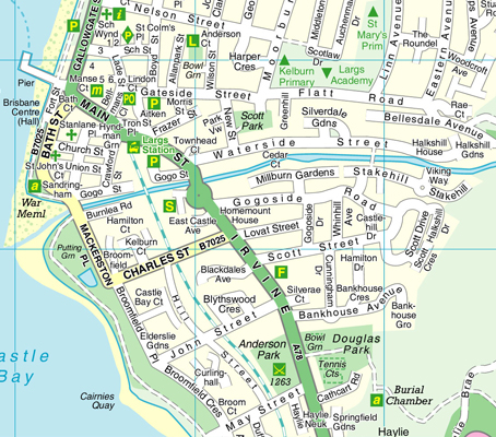
Street Mapping
Our street maps are available as either a fold out paper map or in book format as a street atlas. The ‘wee blue’ Street Guide range covers many towns and villages in Scotland.
Since 2016 we have released new mapping for Aberdeen, Ayrshire, Carlisle, Dumfries & Galloway, East Kilbride, Fife, Glasgow, Inverness, Stirling and Moray & Speyside.
For more information, please phone 01475 689242 or e-mail maps@nicolsondigital.


Custom/Bespoke Mapping
Customised/Bespoke Mapping solutions made specially for you or your business. Mapping for brochures, leaflets and fliers, for both printed and web solutions. Using data from our extensive databases we can make the perfect map for your business needs.

Historic Mapping
Historical Mapping is available as an A3 sized extract centred on your chosen site. We refer to this as an Historical Map report and gives you all available mapping at scales of 1/10560 (6” to 1 mile) or 1/10000, 1/2500 or 1/1250. Our access to historical Ordnance Survey Mapping dates from about 1840 onwards depending on your chosen area.
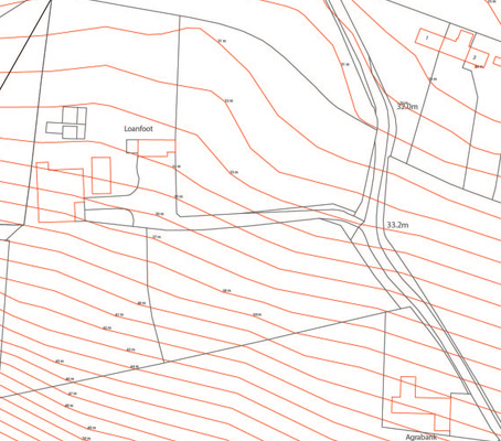
Specialist Mapping
Specialist Mapping including Height Data, Ariel Imagery, Geological mapping and a wide variety of Environmental reports are all available.
If you are not sure what you are looking for please contact 01475 689242 or email maps@nicolsondigital.com